Cristian Gudasz

Airborne Limnological Observatory

Airborne Limnological Observatory

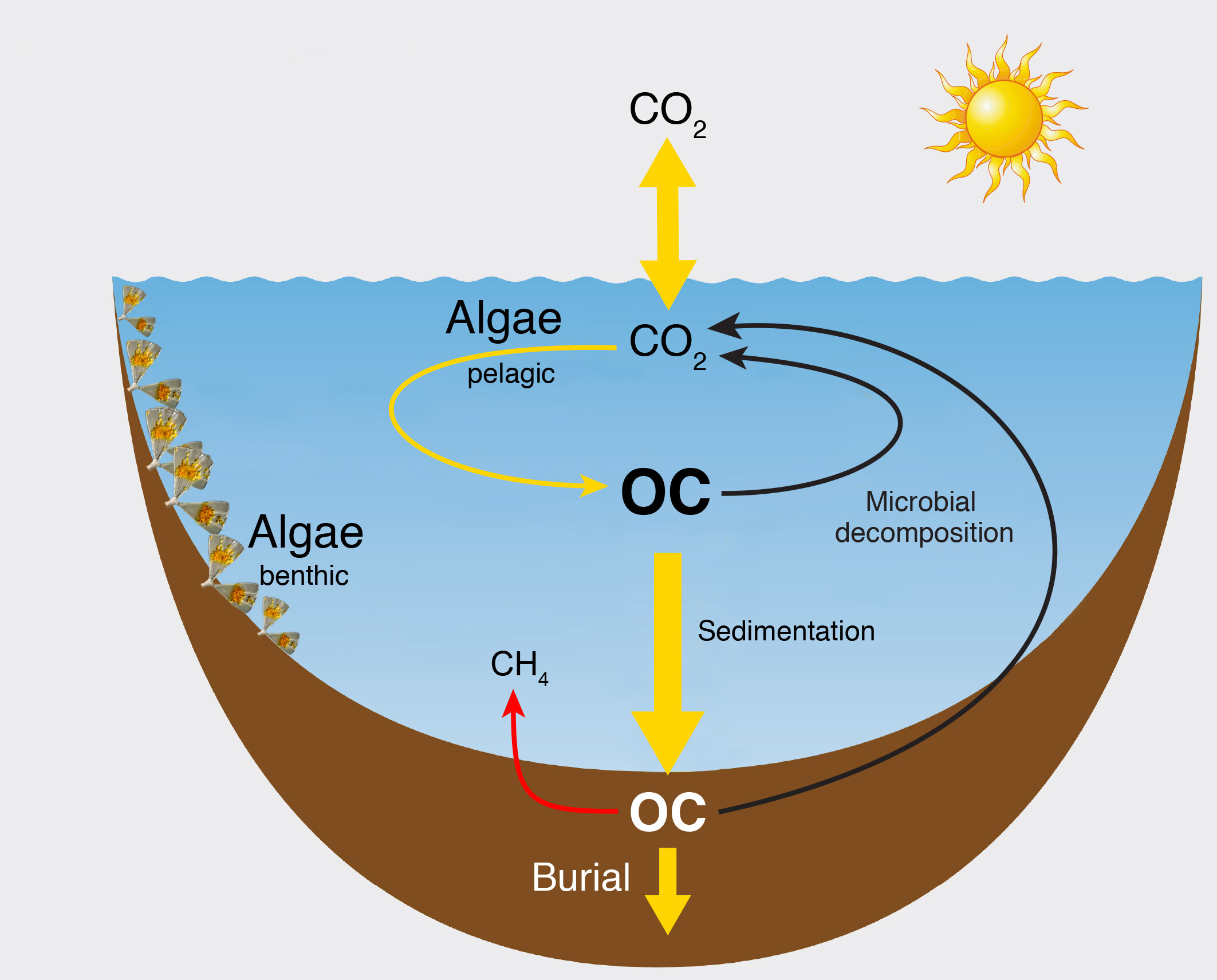
Identifying and quantifying current and future climate impacts on lake ecosystems processes such as greenhouse gas emission and carbon burial in sediments at landscape scales is at the forefront of current research. Landscape scale lake models make it possible to answer these questions. However, models are as good as their validation. For such an approach to be successful, it is necessary to use large datasets of ecosystem level observations carried out at landscape scales.  

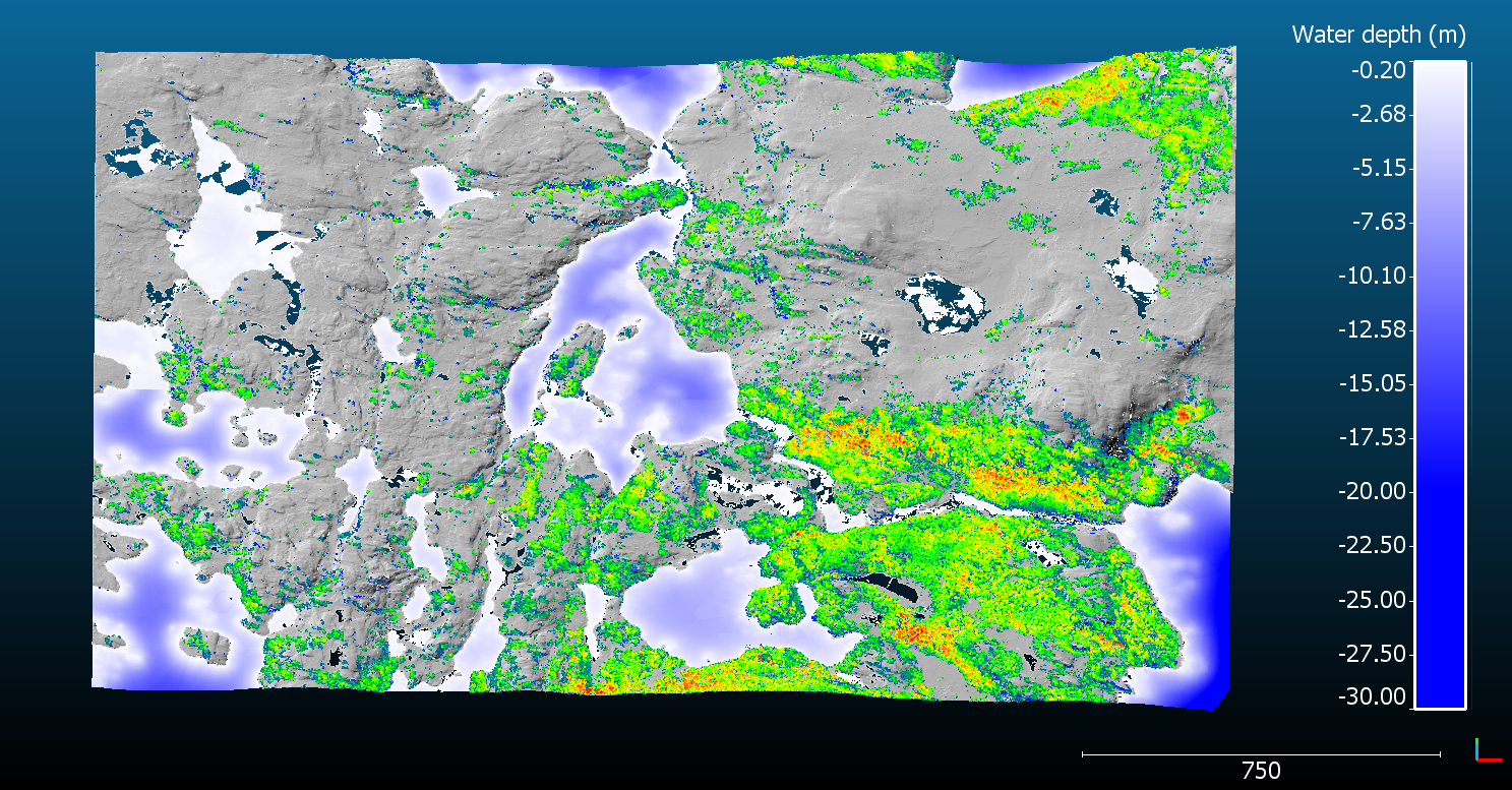
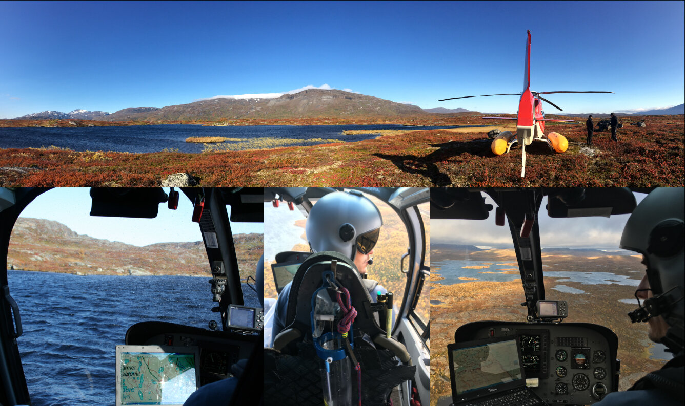
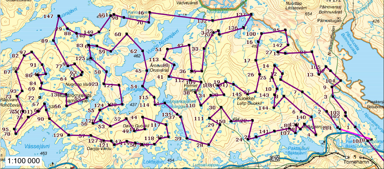
To overcome this limitation I have worked to develop lake data gathering at large scales using helicopter based sampling and measurements. Hence, during September 2017, I set a pilot program to sample 150 lakes in the Abisko region of the Swedish arctic. We used a Eurocopter 120B modified helicopter and equipped with floats and which allows landing on the lake surface and carry out lake water sampling and deployment of fast measuring sensor. This work set the beginning of developing helicopter based lake sampling and more complex measurements into a research platform: The Airborne Limnological Observatory.

This pilot survey has already resulted in a published paper (Berggren et al. 2019, Limnology and Oceanography) indicating that browning of subarctic lakes systematically change the way that bacteria interact with the ambient dissolved organic matter pool.

Hydrogen Isotopes

Stable Isotope Ratios of Nonexchangeable H in Organic Matter

Lake carbon sources are a mix of different proportions of terrestrial plants and internally produced organic matter. Attributing source contribution in lakes of carbon pools and fluxes is essential for understanding how they work or how they respond to climate change. The organic matter produced by terrestrial plants has a very different isotopic signature compared to algae growing in lakes. Stable Isotope Ratios of Nonexchangeable H is a promising novel tool that is able to attribute the relative sources and contributions to aquatic ecosystems However, measurements are still difficult to carry out and availability is limited. My work over the last years has been to develop sample preparation and analysis. I have built new equipment for offline sample preparation, optimized sample treatment procedure and carried out experiments to understand critical aspects for these analyses.

Topo-Bathymetric Surveys

Topo-Bathymetric LiDAR and Multibeam sonar lake surveys

Figure. Topo-bathymetric profile of a hypothetical lake near Abisko, Sweden.

Figure. Topo-bathymetric profile of a hypothetical lake near Abisko, Sweden.

Spatially explicit landscape-scale lake ecosystem models are essential for understanding current and future feedbacks to climate. However, they rely on accurate spatial information of both topography and lake bathymetry. Landscape-scale bathymetric surveys are difficult to carry out with conventional sonars with hundreds of thousands of lakes need to be surveyed. Airborne bathymetric surveys using LiDAR shows promise but rarely used to map lakes.

Hence, to setup a landscape-scale spatially explicit lake ecosystem model in the Abisko region of the Swedish Arctic, I have organized an airborne topo-bathymetric LiDAR survey in collaboration with Dimitri Lague at University of Rennes, France. This survey covered 126 km2 with compromising hundreds of lakes. During August 2020 in collaboration with Terratec Norway, we are carrying out a test flight using the CZMIL Nova an advanced bathymetric LiDAR.

In order to complement the airborne lake bathymetric surveys, I have been using the SONOBOT, a multibeam autonomous hydrography survey platform.

Lake Carbon Cycle

The organic C cycle and impacts of climate warming in high latitude lakes

Figure 1. Representation of a lake organic carbon (C) cycle driven exclusively by internal primary production from benthic and pelagic algae sources. It is seldom the case.

Figure 2. Lake organic C cycle where external inputs of various degrees contribute. In this case, terrestrial plant organic matter stored in soils is typically transported to lakes by runoff. The C export is typically low due to low terrestrial productivity at these latitudes. The presence of areas with permafrost can have an additional contribution of C export when thawing.

Figure 3. Likely impacts of climate warming on high latitude lake C cycle. In regions with pronounced Arctic greening (i.e. increased terrestrial productivity and shifts in vegetation patterns) and permafrost thaw can result in increased terrestrial C export to lakes (positive sign) and lakes can became brown colored. Increased terrestrial C contribution to lakes enhances carbon dioxide emission, methane production and C burial. At the same time due to the reduction in light conditions associated with increased terrestrial organic matter inputs, primary production from both benthic and pelagic sources can decrease (negative sign). This response follows a nonlinear pattern where small terrestrial organic matter inputs can have a positive effect on primary production followed by a decline with ever-increasing inputs. Unraveling the interaction of variables such as nutrients, lake morphometry and climate with the different components of lake C cycle is at the core of ongoing research.